The walking tour by the Aigüestortes and Estany de Sant Maurici National Park.
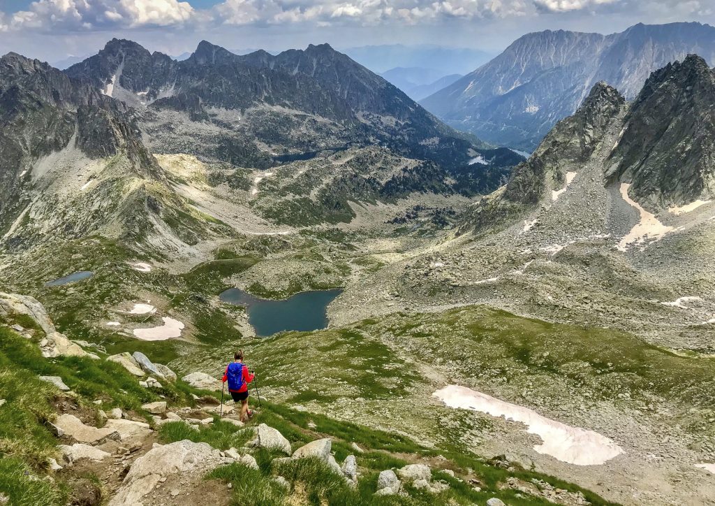
CAMINS VIUS pursues the promotion of the hiking as Local development instrument through the creation a bypass itinerary of the Aigüestortes and Estany de Sant Maurici National Park, starting from the recovery of the historic paths that since time immemorial have communicated 6 valleys that surround it: Valls d’Àneu, Vall d’Àssua, Vall Fosca, Vall de Boí, Vall de Barrabés and Val d’Aran; and goes through 3 historic mountain passes: Port de Vielha, Port de la Bonaigua and Port de Rus. Which are put at the service of an hiking experience that contributes to discover and know the history and culture they express.
VIELHA, Val d’Aran (Google Map)
1 Hour Before Start Time
CAMINS VIUS pursues the promotion of the hiking as Local development instrument through the creation a bypass itinerary of the Aigüestortes and Estany de Sant Maurici National Park, starting from the recovery of the historic paths that since time immemorial have communicated 6 valleys that surround it: Valls d’Àneu, Vall d’Àssua, Vall Fosca, Vall de Boí, Vall de Barrabés and Val d’Aran; and goes through 3 historic mountain passes: Port de Vielha, Port de la Bonaigua and Port de Rus. Which are put at the service of an hiking experience that contributes to discover and know the history and culture they express.
Check-in at Hotel from 14.00H.
Collected of vouchers at the CAMINS office (Avda. Pas d’Arrò, 5 – Galerías Giles) in Vielha.
Opening hours:
From Monday to Friday: from 9.00H to 13.00H | from 17.00H to 20.00H.
Saturday and Sunday: from 17.00H to 20.00H.
Itinerary: Vielha (974m), Betren, Escunhau, Garòs, Arties, Gessa, Salardú (1.268m)
The 10 km that separate Vielha de Salardu pass through the main bottom of the Valley harness, which unites, with its waters, the river Garonne. The landscape is a meadows variety, vegetation lines and forests. To all this there is added the typical villages like Escunhau, Garòs and Gessa among others. In this stretch, we can also view, at the right hand, the perpendicular valleys of Bargadera and Valarties while on the left hand, we’ll find the narrow precipices that fall from the Tuc de Ombèr and Tuc de Arena, 2.523 m.
Itinerary: Salardú (1.268 m), Baqueira 1500, Val de Ruda, Estanyets del Cap del Port (2060 m), Port de la Bonaigua (2072 m), Mare de Déu de les Ares (1760 m), Cascada del Salt de Comials (1660 m) Refugio del Gerdar (1550 m)
In this stage we’ll walk by the South slope of the Pyrenees, by the Port de la Bonaigua. The Garona River, Aranese River that births in the Pla de Beret, in the dividing of waters where it also does it the Noguera Pallaresa River. Along this stretch we’ll find the Aiguamòg and the Ruda Rivers. Both flow by glacier valleys of great beatify, with natural meadows, dark forests, and multitude of ponds, waterfalls and high mountains. At Northeast of these valleys, there is the ski station. And when we arrive to the Bonaigua, meadows and more alpine meadows where herds graze in summer. The surrounding peaks are wild, aerial and cold. But at their feet you will find the beautiful lake of Gerber and, a little lower, it grows a unique forest: the Gerdar de Sorpe.
Itinerary: Gerdar de Sorpe (1.550 m), Pas del Coro (1.946 m), Coll de Fogueruix (2.080 m), Espot (1.320 m)
This stage is of forest character. The Gerdar de sore joins to the Mata de València and these make the largest surface of fir trees in the Iberian Peninsula. In spite of the thousands of trees that will find, there are peaks that we can’t fail to complete like the Pui de les Ares or the Bonaigua or the Tesol characteristic. The descent to Son village leads us to a new landscape, full of meadows and ravines worthy of being contemplated with tranquillity. Passing the Pas de Coro, the route enters a wooded shade that lets us to look the opposite slope, the Solana de Son. It’s a zone with forest and a lot of meadows like the one we’ll find around the Pla de la Font shelter (hut).
This stage will give us the magical feeling of being surrounded by nature everywhere.
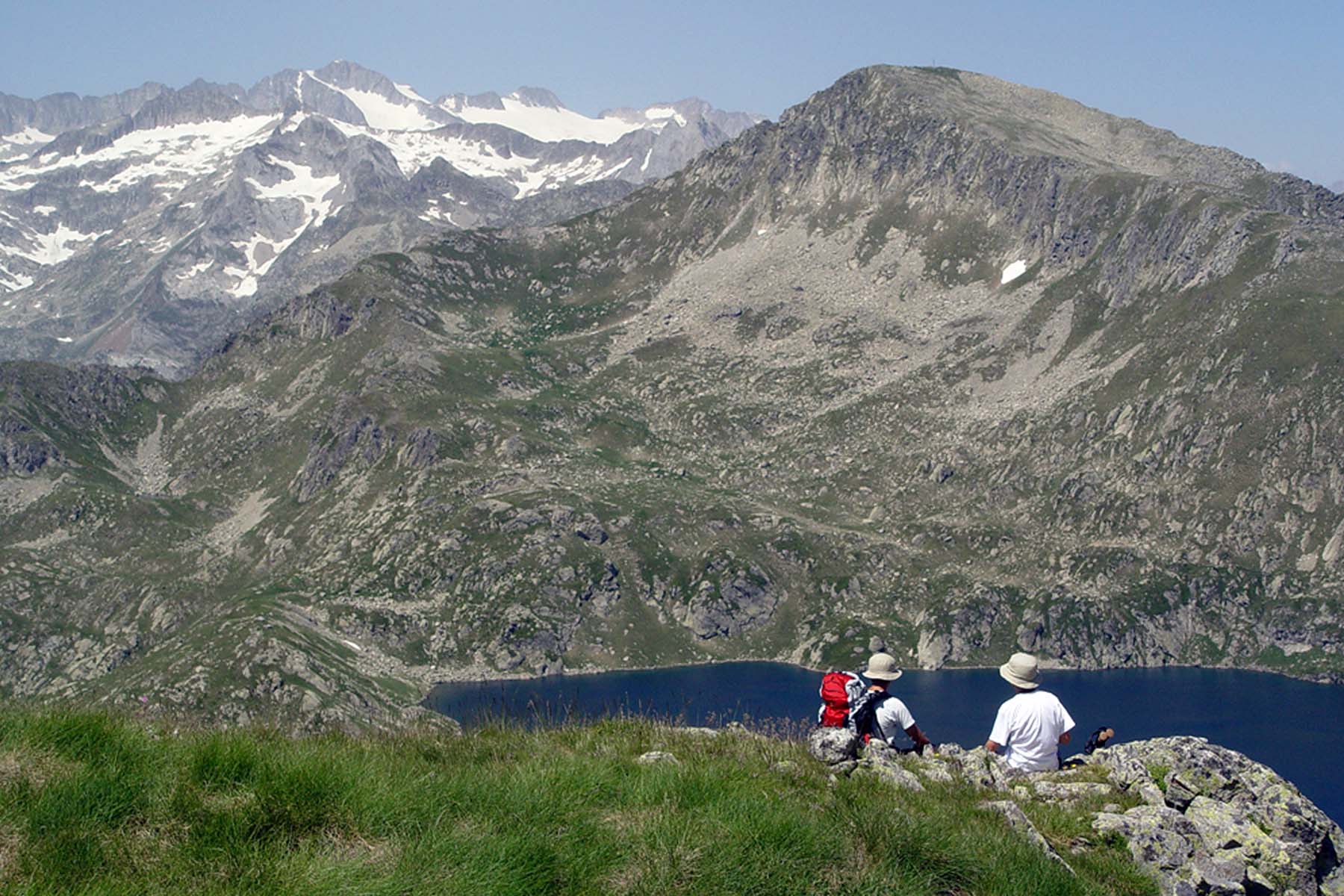
Itinerary: Espot (1.320 m), Valle de Peguera, Refugio Josep mª Blanc (2.350 m), Estany Negre de Peguera (2.325 m), Coll de Saburo (2.675 m), Paso del Oso, Refugio Colomina (2.395 m)
Amazing lakes set of High Mountain between those who highlight the Estany Negre, the deepest of the National Park. Near the lake it finds the Josep Mª Blanc shelter (hut), placed in a bucolic mountain environment next to the Estany Tort de Peguera, from where it is easier to access, to the upper part of the valley, occupied by a rosary of small lakes and surrounded by granitic peaks like those of the Mainera, Saburó and Peguera of almost 3.000 m of high.
The Paso del Oso, walkway built by the workers who built the dams at the beginning of the XX century
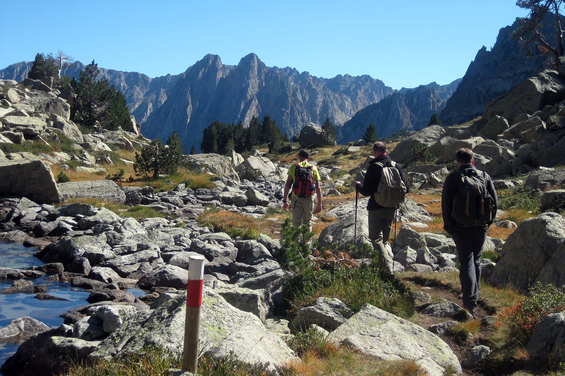
Itinerary: Refugio Colomina (2.395 m), Estany de Tort, Estany de Cubieso, Estany Tort Coll de Dellui (2577 m), Refugi Llong, St. Nicolau d’Aigüestortes
Tour through a big cirque full of Great Lakes like the Tort (one of the most extensive and the longest of the park), Mariolo, Cubieso… all of them surrounded by great peaks.
The Coll de Dellui, a hill that lies on the edge of the Vall de Boí and the Torre de Capdella (Pallars Jussà).
Itinerary: Boí, Erill La Vall (1.260 m), Coll de Basco, Port de la Gelada (2.069m), Senet (1.205 m), Aneto (1.380 m)
At highlight the Collado with the best views of the Boí valley and the mountains of Aigüestortes National Park. The Port de la Gelada where you will find the Barravés valley and its surrounding mountains: Pico de la Tallada, Vallibierna, Rusell and Aneto peak. Granite mountains over three thousand meters high, beech forests and nearly 40 lakes distributed throughout the different valleys, together with the traditional torchlight processions held on the night of St. John’s day all combine in an example of natural and cultural heritage that is well worth discovering. The Information Centre of the Aigüestortes and Estany de Sant Maurici National Park is in the village of Senet.
Itinerary: Aneto (1.380 m ), Espitau de Vielha (1.620 m), Port de Vielha (2.442 m), Bosca Norte del Túnel de Vielha (1.380 m), Vielha (980 m)
From Aneto to Espitau de Vielha by taxi.
The Pòrt de Vielha is one of the great classics in the Val d’Aran. Transit point for people, livestock and goods, Pòrt de Vielha is steeped in history. Throughout the centuries, and more so after the opening of the tunnel, it has been one of the most important crossover points between the north and south sides of the central Pyrenees. A point where the waters divide towards the Atlantic or the Mediterranean, and where the views towards Feixans, Molières, Aneto and Maladeta are truly privileged.
At highlight the old “Vielha Hospital” with its sanctuary is a building full of history. The high mountain feel and Pass with its splendid views. Direct arrival to the main square of Vielha, with the Romanesque church of St. Miquel.
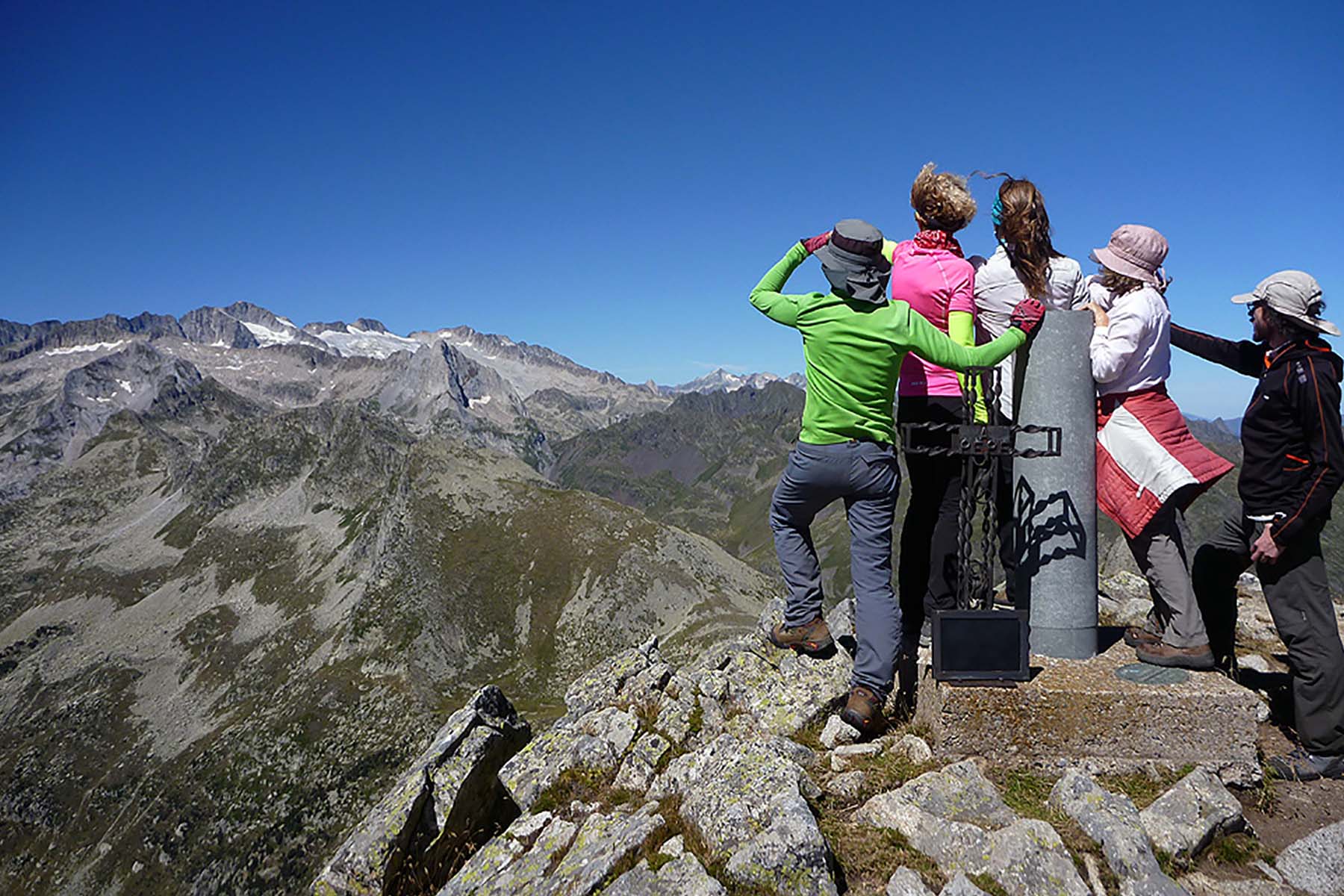
We recommend the ascension of the Tuc deth Port de Vielha. Between going up and down about 2 Hours. A fantastic views of the Aneto peak and Maladetas.